
English| EUR
Suggested for you
More currencies
Choose a language
West of Santiago de Compostela the waymarking does not stop. It carries on for roughly 90 kilometres through eucalyptus woods and along the Costa da Morte to a headland the Romans treated as the edge of the known world. This santiago to finisterre route guide sets out what the walk actually involves, how walkers divide it, and what awaits at the Faro de Fisterra.
Quick answer
The cape itself is open continuously, 00:00–23:59 every day of the week, with free entry to the lighthouse grounds at Faro de Fisterra, 15155 Fisterra, A Coruña. Most walkers cover the roughly 90 kilometres from Santiago in three to five days. Arriving between 19:00 and 21:30 gives sunset light and thinner crowds, though summer evenings draw coach traffic.
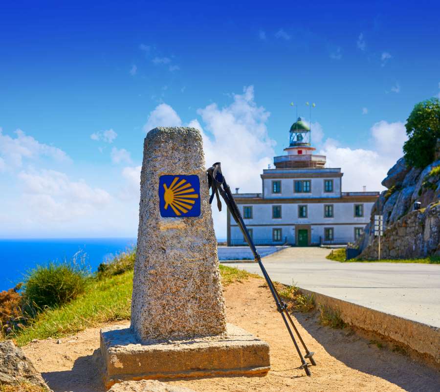
Fisterra is not the westernmost point of mainland Europe — Cabo da Roca in Portugal holds that title by some 16 kilometres — yet it was the cape that Roman surveyors named Finis Terrae, and the misconception has outlived the correction by two thousand years. That gap between geography and myth explains much of what walkers encounter here. The santiago to finisterre route is the only Camino path that runs outward from the cathedral rather than towards it, and it was walked for centuries by pilgrims who felt Santiago de Compostela was a waypoint, not a conclusion. What the reader is dealing with is a genuine continuation of the Camino, not an excursion. Yellow arrows and mojones leave Praza do Obradoiro heading southwest through Negreira, Olveiroa and Cee, and the Xunta de Galicia maintains the waymarking to the same standard as the Camino Francés. A pilgrim credential can still be stamped along the way, and a separate Fisterrana certificate is issued on arrival. Terrain is the surprise: the profile is rolling rather than flat, with river valleys around the Tambre and a long descent to the Atlantic at Cee that punishes tired knees more than any climb. Many walkers add the spur north to Muxía and the Santuario da Virxe da Barca, turning a linear finish into a loop along the Costa da Morte. The context that makes all this legible is the Camino Finisterre's dual character. It is a pilgrimage path with pre-Christian roots — the cape held a sun cult and an ara solis long before the ninth century — and simultaneously a coastal walk with the practical demands of the Galician Atlantic: sea fog, sudden rain, exposed cliff sections above Praia do Rostro. Facilities exist but thin out west of Olveiroa, so booking beds ahead matters in high summer. What to do with the answer is straightforward. Decide first whether the objective is the walking or the arrival. Those who want the full santiago to finisterre route on foot should budget days, not hours, and plan the last stage to land at the lighthouse in the evening window. Those short on time reach the same headland by road and still see the kilometre-zero marker, the boot sculpture and the horizon that ends the path. Both are legitimate finishes; the cape does not distinguish between them.
“It is the only Camino path that runs outward from the cathedral rather than towards it.”
This plan suits walkers of average fitness covering the roughly 90 km waymarked Camino Fisterra on foot, split into four walking days with an optional fifth for a gentler pace. Distances below follow the standard stage towns, ending at the km 0.000 marker beside the lighthouse.
About 21 km, five to six hours from Praza do Obradoiro through Alto do Vento and Ponte Maceira. The climb out of Augapesada is the steepest part of the day, so refill water before it.
The longest stage at roughly 33 km, eight to nine hours via Vilaserío and Santa Mariña. Walkers wanting five days instead of four stop at Santa Mariña after about 13 km and continue next morning.
Around 20 km, five to six hours, passing the Ermida das Neves turn-off and cresting near Hospital where the Atlantic first appears. The descent into Cee is long and stony underfoot.
A short 12 to 15 km, three to four hours along Estorde, Sardiñeiro and the sands of Praia de Langosteira. Many walkers cover this before lunch and leave the afternoon free.
The final 3.4 km climbs past the Igrexa de Santa María das Areas to the cape, taking 45 to 60 minutes each way on a paved shoulder. Timing the walk to reach the grounds between 19:00 and 21:30 puts you there for the low sun.
Walkers either retrace the coast north toward Muxía, adding a 29 km stage, or arrange onward transport from Fisterra village. Decide before your last night, as the two options leave from different ends of town.
Cape Finisterre is located on the western coast of Galicia, accessible from Santiago de Compostela via regional bus services or private vehicle. Travelers concluding the pilgrimage on foot will arrive at the town of Fisterra before completing the final transit to the lighthouse.
Monbus service from Santiago de Compostela bus station to Fisterra
AC-441 and AC-445 roads from Santiago de Compostela
Camino de Santiago extension from Fisterra town to Faro de Fisterra
Local taxi service from Fisterra center to Faro de Fisterra
The lighthouse grounds are located at Faro de Fisterra, 15155 Fisterra, A Coruña, Spain. The best arrival window is 19:00–21:30, which provides optimal timing for sunset views and avoids peak daytime crowds.
The period between May and September offers the most stable weather for the trek to Cape Finisterre. To manage daily crowd levels, prioritize an arrival during the best arrival window: 19:00–21:30.
Mild, 15°C to 20°C
Ideal conditions for walking before the peak summer heat. Routes are active but manageable.
Warm, 20°C to 25°C
Expect higher density on paths and at the cape. Ensure accommodation is planned well in advance.
Cool, 12°C to 18°C
Fewer pilgrims and pleasant temperatures for the final coastal stretches. Stable conditions for sunset viewing.
—
Plan your final approach to reach the lighthouse within the 19:00–21:30 window to secure a vantage point for the sunset.
Verdict: The best time for the route is May, June, or September, specifically timing your final arrival for the 19:00–21:30 window.
The lighthouse grounds at Cape Finisterre are accessible to visitors throughout the entire week.
Everything you need to know about santiago to finisterre route
The santiago to finisterre route typically spans about 90 kilometers and usually takes hikers four to five days to complete depending on their daily pace. This coastal pilgrimage extension offers a unique journey ending at the Atlantic Ocean.
Access to the Cape Finisterre lighthouse and its surrounding grounds is completely free of charge. There is no entrance fee required to visit this landmark at the end of the santiago to finisterre route.
The optimal time to arrive is between 19:00 and 21:30 to experience the sunset while avoiding peak daytime crowds. Arriving during this window allows visitors to witness the coastal transition as daylight fades.
The Camino de Fisterra is a historic pilgrim path that continues beyond Santiago de Compostela toward the Costa da Morte. It serves as a symbolic conclusion to the traditional pilgrimage experience.
The site remains accessible every day of the week from 00:00 to 23:59. These hours apply consistently throughout the year, ensuring visitors can visit the lighthouse area at their convenience.
Yes, families often enjoy the santiago to finisterre route because the path is well-marked and passes through various villages with services. It is recommended to plan shorter daily walking stages to accommodate younger travelers.
Hikers should bring comfortable walking shoes, weather-appropriate clothing for the Galician coast, a reliable rain jacket, and a daypack. Carrying sufficient water and basic first-aid supplies is also essential for the trek.
No special permits are required to walk the santiago to finisterre route. Pilgrims typically carry their credential or pilgrim passport, which can be stamped along the way to verify their journey.